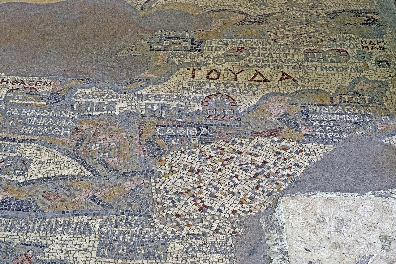
Madaba Map
خارطة مادبا
mosaic in
Madaba Governorate
#3 in Madaba Governorate
/
#18 in Jordan
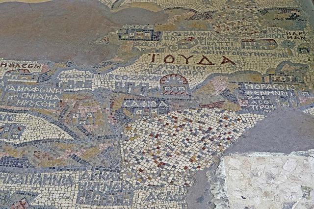
The Madaba Map is a remarkable 6th-century mosaic map located in the early Byzantine church of Saint George in the town of Madaba, Jordan. This ancient cartographic masterpiece depicts the Holy Land and surrounding regions, offering a detailed portrayal of biblical geography. The map is particularly noted for its depiction of Jerusalem with notable precision, including key landmarks such as the Church of the Holy Sepulchre. Measuring approximately 16 by 5 meters at its largest, the Madaba Map provides invaluable insights into the urban layout and significant sites of the region during the Byzantine period.
Hotels
Find hotels nearby:
Tours & Activities
Also check out
.JPG)
Message
Go to Planner